Fri
Like the huts we will stay in, the lodge is run by the AMC, but many of the guests are not hikers and are staying at the lodge on their way to other activities. Our group is 23 this year, much larger than last year.
Sat
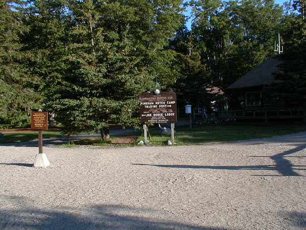
Our first hut is Mizpah Spring Hut (3800') and the approaches
are not long (but about 2000' gain) so we will have an easy first day.
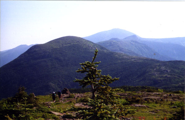
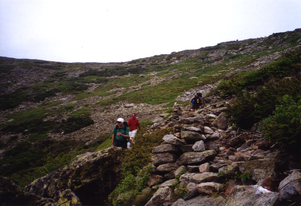
About half of the party started up the Webster Cliff Trail (6.4 mi to hut)
at about 9:30. This approach is longer and has a very steep section
but offers great views from along the ridge leading up to Mt Webster.
A few took the shortest approach (about 2 mi), the Crawford Path and
the Mizpah Cutoff. The Crawford Path was the first trail up Mt Washington
and we will be hiking along other parts of it on subsequent days.
The drivers (getting a later start) went up the Webster-Jackson Trail.
Some to Mt Jackson (the most south of the Presidentials, 4052',
MtWebster,
3910' is further south but only peaks over 4000' are named for presidents)
and then followed the Webster Cliff Trail on to the hut (4.3 mi).
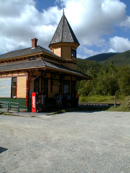
Crawford Notch Vistor's Center in old train station.
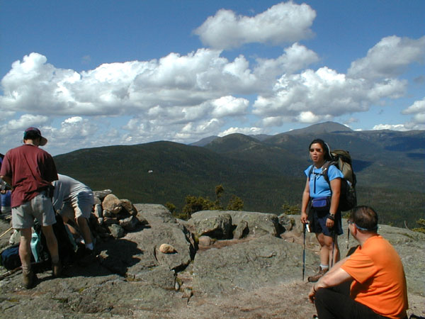
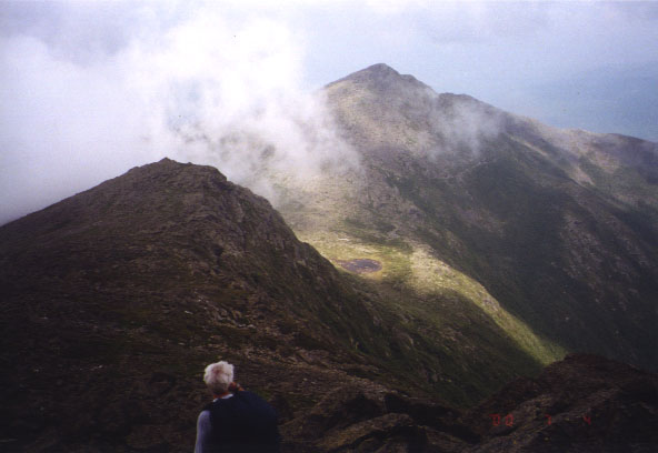
View from top of Mt Jackson with Mt Washington in the distance (right of center, over Janet's head).
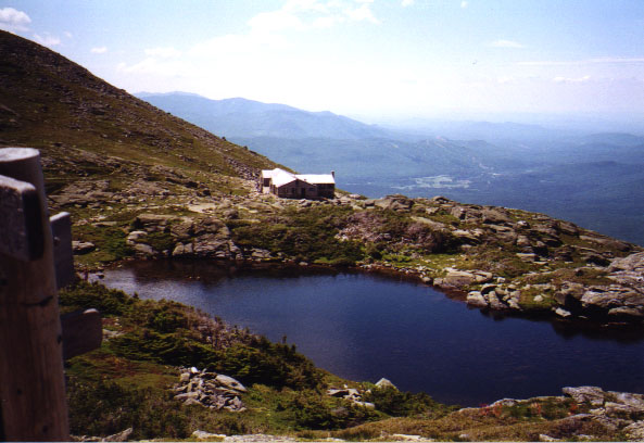
The weather is great, sunny, low humidity and not too warm. The sky is unusually clear and we get great views all the way to Mt Washington from the Webster Cliff Trail. All of our party are at the hut by late afternoon and we choose our bunks are relax until dinner (6:00 PM). Mizpah has a number of small bunk rooms holding 12 or so beds with a total capacity of 60.
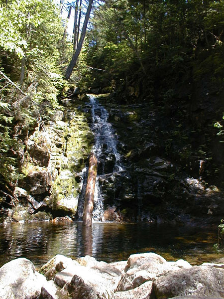
Waterfall on Webster branch trail
After dinner, one of the "croo" (the students who staff the huts) offers a short tour of the flora near the hut and another a tour of the power and composing systems. Mizpah has the new composting toilet system that we saw at Lonesome Lake Hut last year and, like all the huts we staying this year, has both solar panels and wind generators for electricity. The huts use propane for cooking and to power backup generators, but use battery power for refrigeration, water pump, lights and radio.
Like all the huts, lights are turned out at 9:30. This begins "quiet time" and most hikers are ready to retire after a high-energy day on the trail (and knowing that the croo will wake us up at 6:30AM). Some with flashlights or headlamps continue reading or playing cards for awhile. Unlike last year I have no problem falling asleep this early.
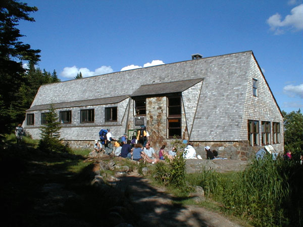
Mizpah Spring Hut
Sun
We notice that Mizpah has very few raid items. Hut crews will
drive and hike to another hut during the night and attempt to steal certain
collectible objects (road signs, large wooden spoons, an old airplane propeller,
etc.) without getting stopped. If they can get out of the hut building
before being caught, they can take the objects back to their own hut.
Mizpah recently lost most of their items in a raid and hasn't had time
to raid another hut to "refurnish" their. Mizpah is one of the easier
huts to get too and so has trouble hanging on to their collection.
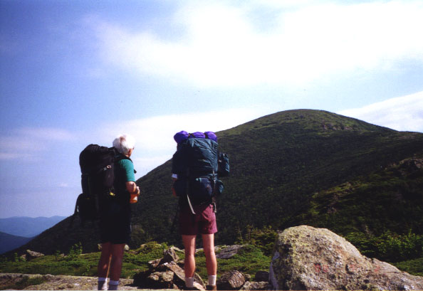
From Mizpah, we climb over Mt Pierce (4312') and rejoin the Crawford
Path, continuing over Mt Eisenhower (4760'), Mt Franklin
(5001') and Mt Monroe (5372'), and down to Lakes of the Clouds
Hut (5012'), a total of 5 mi and 2200' of climbing (half in the initial
climb to Mt Pierce). Almost the entire route is above timberline.
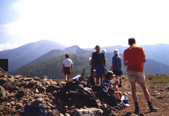
We arrive at Lakes Hut about noon.
Again we have beautiful weather, sunny and clear with wonderful views
of Mt Washington. The view from the hut includes not only Mt Washington,
but a view down the valley to the Mt Washington Hotel's red roof, 3000'
below. Two days in a row with no clouds covering the summit is unusual.
We will be spending two nights at Lakes and so tomorrow will be day hikes
on parts of Mt Washington, but the weather report predicts showers tomorrow
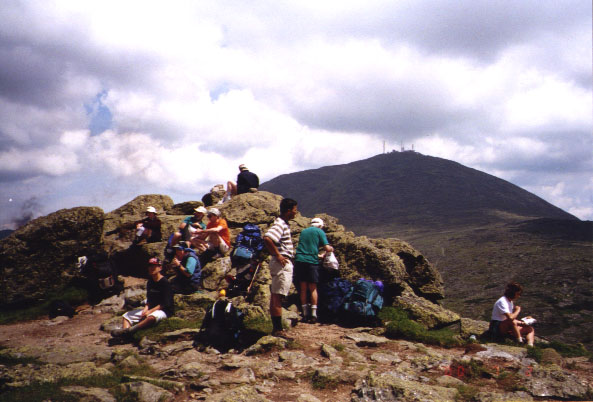
and so most of the group decided to climb Mt Washington (6288')
this afternoon while it is clear. We climb to the top in about 1
hr and spend a couple of hours before returning to the hut well before
dinner.
Mt Washington has an auto road and a cog railway to the top and so we
see tourists, but many of us also enjoy a Ben & Jerry's ice cream bar
- a rare opportunity in the wilderness. The view is wonderful.
We look at the peaks to the north that we will climb over on Tuesday.
Lakes Hut is the largest in the system with 90 beds separated into rooms
of varying size. Some with as many as 15 beds. Our group has
been assigned two rooms.
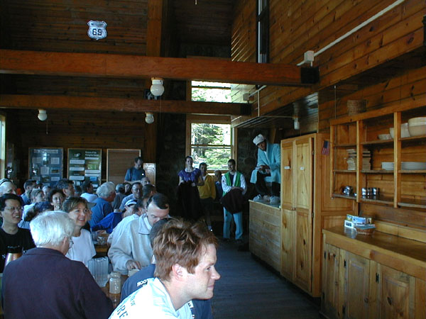
The food, as usual, is good and plentious. Dinner at each hut
begins with soup (usually including whatever was left from the previous
night's dinner), and fresh backed bread, followed by salad and entree and
a vegetable. This followed by the croo introducing themselves, explaining
the rules, answering questions and finally desert and coffee. This
year each hut announced a very disgusting desert (often based on leftovers)
and then explained that a member of the croo ate it all and so they had
to make a new desert (most often some form of brownie or chocolate cake).
Tonight we see the hut serve dinner to a few through hikers after we
are done. "Through hikers" are hikers doing the Appalachian Trail
(entire or multiday pieces). The huts allow them to buy dinner (if
there is any left), free beds if there are any spare or to sleep on the
floor of the dining room if they desire.
After lights out at 9:30 a few of us are still reading with our headlamps and we notice fireworks in the valley. The Mt Washington Hotel is having its annual fireworks display tonight. It is one of the largest displays in NH and the few not in bed watch it for over 1/2 hr from the dining room windows.
Croo Skit after breakfast at Mizpah (croo in chair is using remote to channel surf - one channel shows how to fold blanket, etc.)
getting ready to leave Mizpah
Atop Mt Pierce
On our way to Mt Eisenhower (Mt Monroe and Mt Washington to right).
Joe and Catherine Looking at Eisenhower from Mt Pierce
Atop Mt Eisenhower (Mt Monroe and Mt Washington to left)
Atop Mt Monroe (Mt Washington behind)

Our first view of Lakes of the Clouds Hut (and lake) as we decend Mt Monroe
View of Lakes Hut coming down from Mt Washington (valley distance to right with Mt Washington Hotel)
Nearing the top of Mt Washington
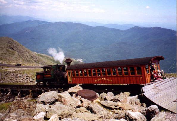
The Cog Railway
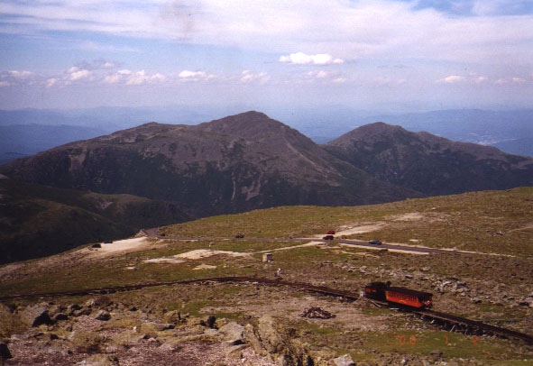
The Cog Railway decending with Mt Adams (right) and Mt Madison (left) in distance
Mon
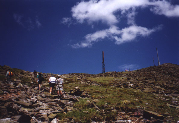
Some of us hike over Nelson's Crag and Ball Crag on the way to the top.
There has been a weather observatory at the top of Mt Washington since
1932. This is one of the largest non-profit, non-governmental weather
observatories in the world - supported by member donations and research
contracts. Normally only members are allowed to tour the facilities
but two of our group who are members asked and they agreed to give our
entire group a tour. We were able to climb to the top of their tower
and see the wind instruments. The previous location of the observatory
on the east side of the top is where the highest windspeed ever recorded
(231 mph) was measured in Aug 1934.
Some take the opportunity to visit the snack bar at the top for clam
chouder, chili or chili dogs.
A few do other trails down into Tuckerman Ravine or the Jewell Trail
down the western slope to the lower end of the cog railway and back up
the Ammonoosuc Ravine Trail to the hut.
Dinner tonight is a good as ever. We notice that Lakes Hut now has posession of the most desirable raid item of all, the famous airplane propeller. Lakes thinks it should be theirs since it came from a plane crash on the western slope of Mt Washington in the 1950's and the Lakes croo was the first on the scene, bringing the propeller back to the hut. But of course every other hut wants to raid it away. Lakes had retrieved it from Lonesome Lake Hut only a couple of weeks earlier. We found it attached to the ceiling beem by large chains and bolts - they'd like to keep it awhile.
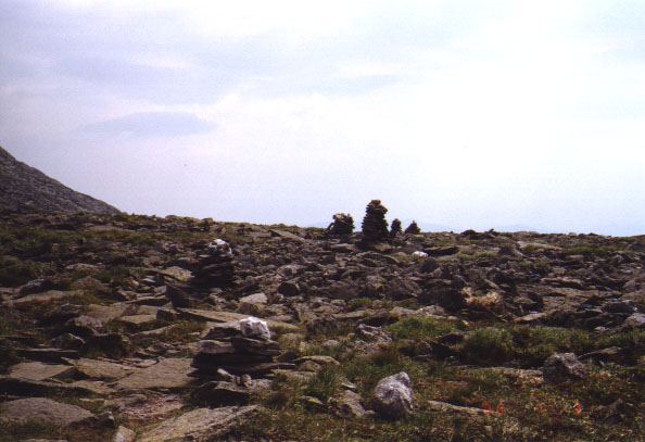
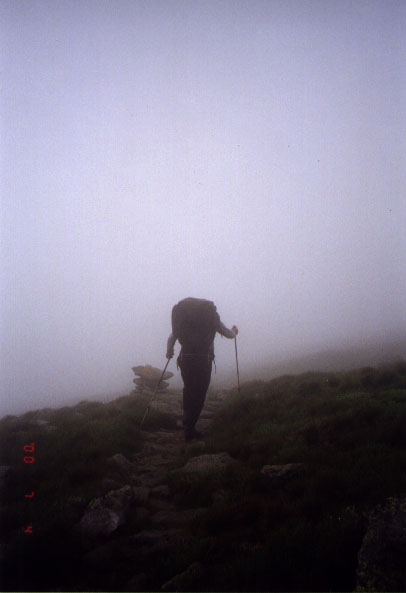
Cairns to follow trail across boulder fields in fog
The Alpine Garden Trail
View into Tuckerman Ravine

Nelson Crag
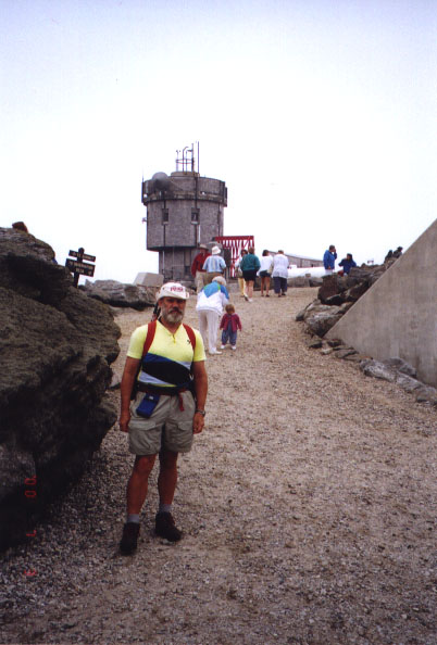
Terry with Weather Observatory behind

At the top of the Weather Observatory
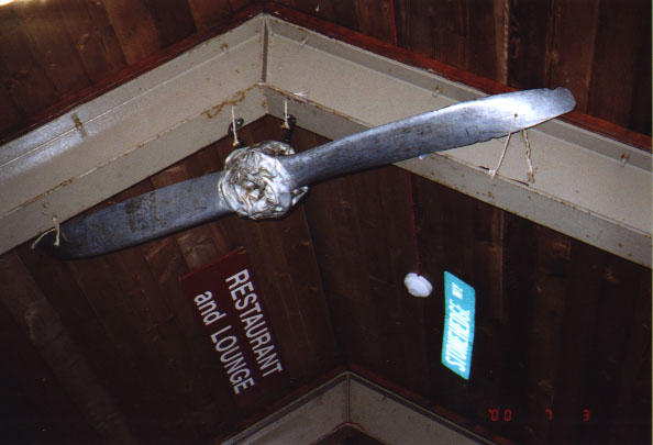
The Propeller (raid item)
Tues
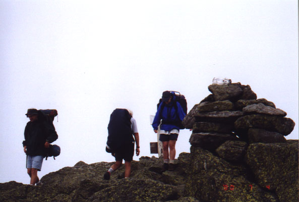
We start in fog and showers and thunderstorms are predicted. We
will be very exposed along this ridge and there are few places to get down
to timberline quickly. Fortunately we encounter only light fog -
and even that clears periodically; we get limited views from every peak.
We walk under the cog railway tracks on the way to Mt Clay, just as a train
goes by and find ourselves the subject of tourist photographs.
The hike is long but I love the views above timberline. We arrive
at Madison Spring mid-afternoon, choose our beds and take a short walk
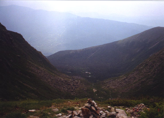
to Star Lake and a nice view into the Great Gulf Wilderness slanting steeply
to the south.
Tonight we get Apple Pie for dessert (in honor of the Fourth).
After dinner we are treated to a rowsing thunder storm, lots of lightning
and heavy rain - kind of exciting above timberline - glad we are in a hut.
The wind rattles the hut throughout the night.
Teun hiking through the fog

Atop Mt Jefferson (we stop for a snack and enjoy the fog)
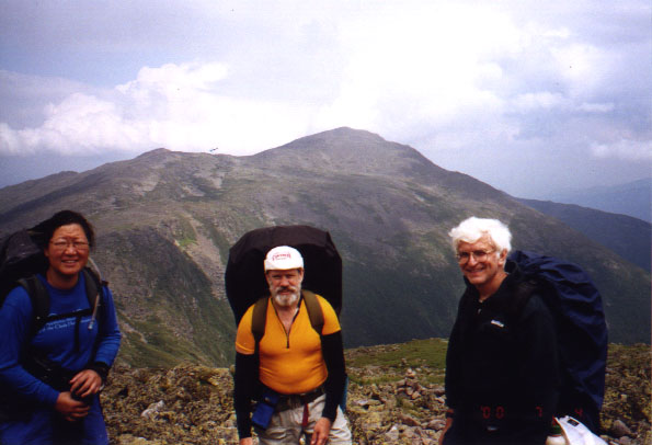
Janet, Terry and Joe with Mt Adams (left) and Mt Madison (center) behind
Atop Mt Madison
Mt J.Q.Adams (left) and Mt Madison (center) from Mt Adams
Wed
We had planned to hike over Mt Madison and continue down the Osgood Trail, but with winds that nearly blow us off our feet, most of the group decide to use the Parapet Trail to hike around Mt Madison's south side to meet the Osgood Trail. This gets us somewhat out of the wind (wind is from the NW). We still have about 1 hr and over 1 mi to timberline and true protections from the wind. Some of the group choose to take the Buttress Trail to decent to timberline faster but adding a mile or two to the distance out. Others take the Valley Way out to Hwy 2 to the north. This is a shorter way out and gets down to timberline almost immediately but does not go to where we parked the cars. A couple of cars will drive around to this trail head to pick them up.
The group going the Parapet Trail make it to the Osgood Trail without major incident, but it is very tricky jumping boulder to boulder with gusts trying to blow you off the mountain. On the Osgood, we follow a ridge for 1/2 mi still battling the wind but with somewhat more protection. After this we reach timberline and are protected from the wind. From here on down we only battle the sloop. We have to lose a total of 3500' so we are going down steeply for 2 mi. This is the roughest yet on my knees but they hold up.
As we decend the temperature rises and we shed clothes until we reach the Great Gulf Trail. This is a nearly flat, 15' wide trail with wooden bridges over streams - a virtual freeway. The last two miles to the cars go very fast.
Most of the group goes Pinkham to shower before heading for home.
I drive around to Hwy 2 to pickup some of my riders who hiked out to the
north. We continue on to Lafayette Campground in Franconia Notch
to shower, after dropping off another hiker from Madison Hut that left
her group that were planning to hike to Lakes in the wind. We dropped
her off at Carter Notch to hike into Mizpah to meet her group a day later.
After the short hike much of the group arrives back at lot where we
parked our cars near the same time. We induce a couple who have just
driven up to take our picture. They didn't realize that we were going
to ask them to use six or seven different cameras.
We drive back (trying to hold our breath) to the Lafayette Campground in Franconia Notch to take showers and change clothes before driving home.