Visit to The Red Center
|
|
(expand your browser window to full or near full screen for
best viewing)
|
| After Caines, I flew to Alice Springs in the "outback". This
area is called the Red Center because of the red sandy soil (red due to
iron oxide) and the fact that it is near the center of Australia (in Northern
Territory). After visiting some historic buildings and aboriginal
art stores, I take a two day tour to Uluru (previously known as Ayer's
Rock) and Kata Tjuta (previously The Olgas). These areas were returned
to the aboriginal a few years ago after a compromise where they agreed
to lease them back to the national park for 99 years. Being owners
however, give them significant input into the management. The aboriginal
names are now commonly used rather than the names given the rocks by Europeans.
We drive through nearly 400 km of desert on the way to Uluru, although
this year it is very unusually green. Last year they had over four
times the normal rainfall (a record) and this year in the first 2 1/2 months
they have already received their normal rainfall for the entire year.
So even at the end of the summer all is green. "Dry" lakes have water
this year. They had to cancel the annual race on the river that runs
through Alice Springs because they use wheeled vehicles and this year the
river has water.
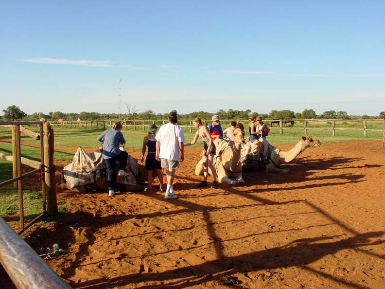
The primary means of travel and shipping across the region until about
1950 was camels. Afghanistani camel drivers brought camels to the
area in the mid-1800's and provided most of the transport. We stopped
by a camel farm on the way to Uluru. |
|
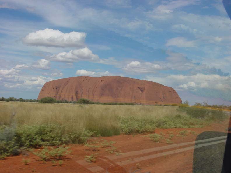
| After a long ride in the bus we finally get our first view of Uluru
(Ayer's Rock). |
|
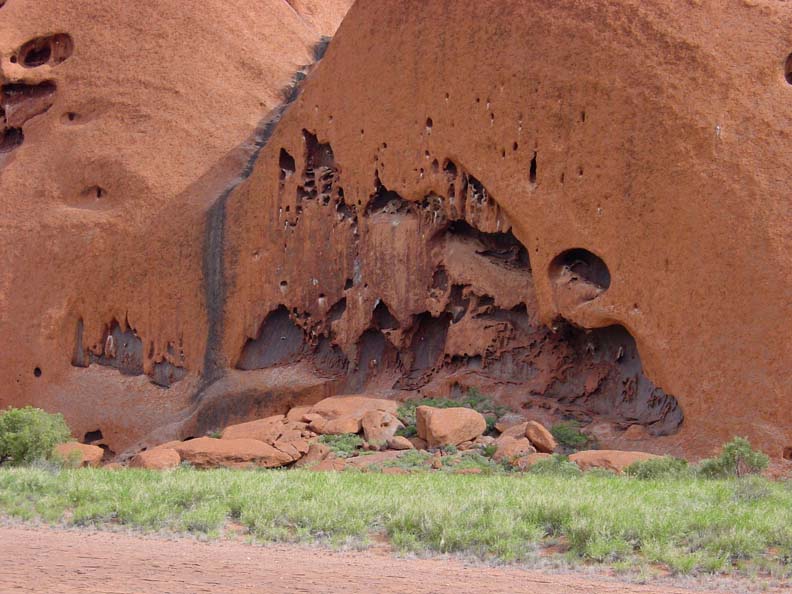
| Some visitors still climb the rock. The aboriginal owners agreed
to allow this although they discourage it. To them Uluru is a very
sacred place. They still use caves and structures of the rock for
religious ceremonies and certain men climb it once a year for a special
ritual, but most of their traditions are only shared with specific parts
of the tribe (some are known only by old men who pass it on to their oldest
sons before they die, other traditions are only known by women who
pass it on to their daughters, etc.). Most of the traditions cannot
be passed to anyone outside the tribe and so little is known or can be
explained to visitors.
But before we visit the rock we set up our camp and have lunch.
The tour company has a permanent camp with tents and a small metal building
for dining. |

|
| None of the group chose to climb Uluru and so we can visit it in the
afternoon (they close the climb whenever the temperature will go above
37 degrees celcius (about 99 degrees F) within two hours, so it is often
open from 1/2hr before dawn to only 8AM and never open if the rock is wet).
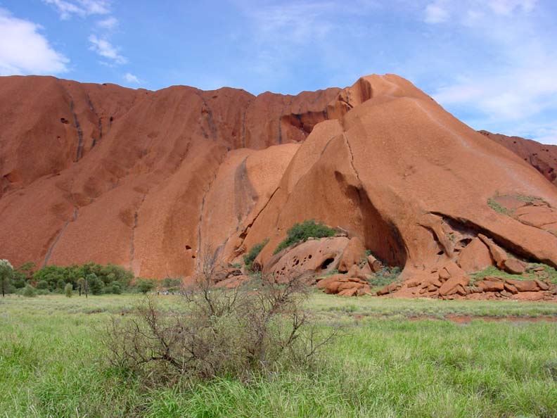
You can see the path taken to climb along the middle of the slope on the
right. Some parts are so steep that they have heavy chain permanently
placed that can be used to hold on to. |
|
| I choose not to climb the rock but to walk the 8 km trail around the
rock. This took us about 2 hr in the heat. Fortunately there
was a place to refill our water bottles half way around. It is amazing
how many different vistas the rock offers. It takes on a different
character from each direction as one walks around the rock. |
|
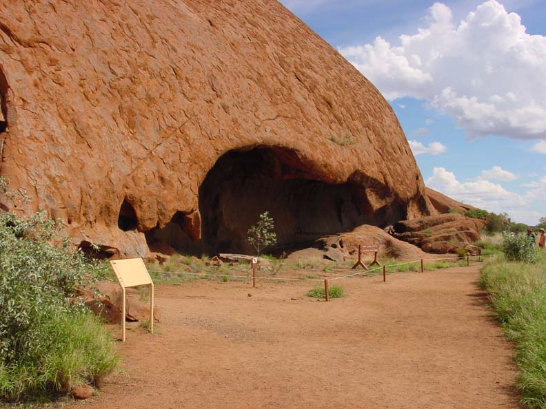
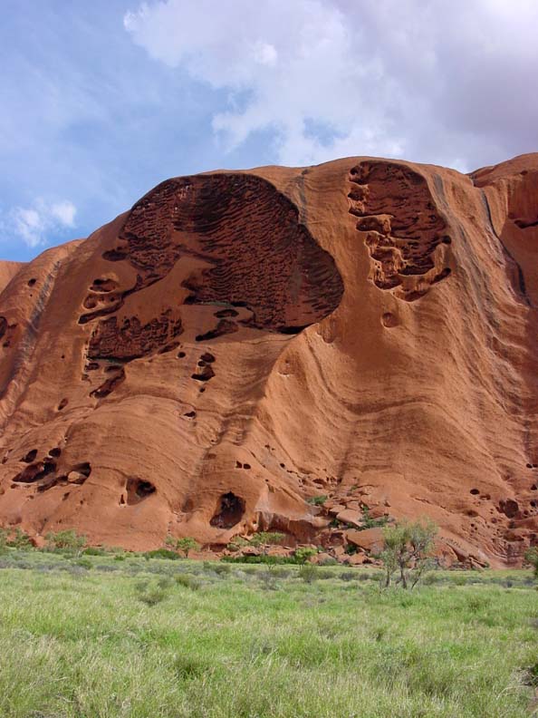
| The aboriginals see images to illustrate their legends in the features
and textures of the rock. Unfortunately they will not share most
of these. |
|
|
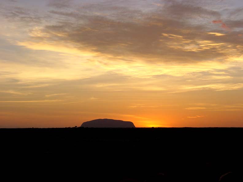
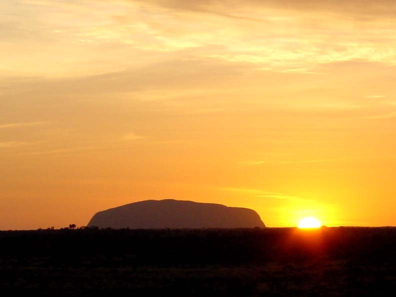
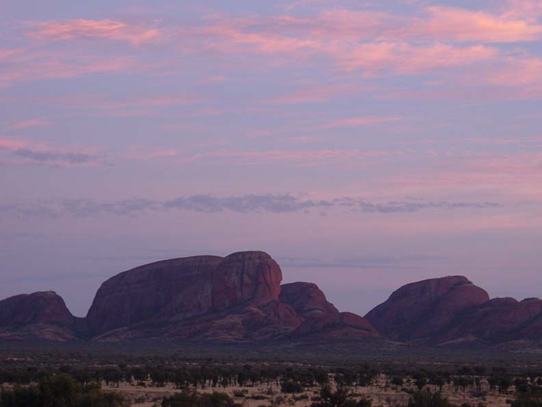
| Sunset is a special time at the rock. The setting sun creates
a changing pattern of colors on the rock. Unfortunately a storm rolled
it just minutes before sunset and we had to rush to the bus from our viewing
area to avoid getting soaked. There were no colors that evening.
But we got up at 5 AM the next morning, leaving the camp by 6 to view the
sunrise from a spot between Uluru and Kata Tjuta. This allowed us
to watch the sun rise behind Uluru and the changing colors on Kata Tjuta. |
|
|
|
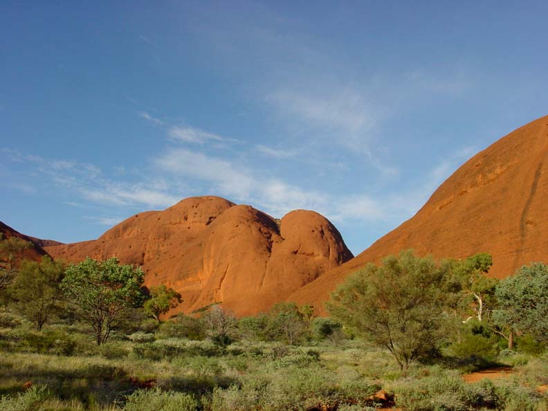
| After watching the sun rise we drive on to Kata Tjuta. The highest
point on Kata Tjuta is a few feet higher than Uluru but, as you can see,
it has much deeper cuts eroded between nearly separated domes. The
strata are at a modest angle, compared to Uluru where the strata are at
nearly 80 degrees from the horizontal (Uluru remains a highly buckled part
of a former strata layer). |
|
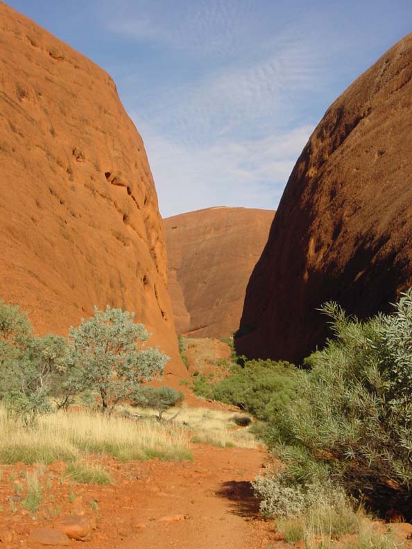
| We "bush walk" along a trail between two domes along the other side
and then back through another cut. In the box canyon below the nearly parallel
rock walls echoed the sounds of the birds nesting in the holes on the left,
creating a nearly continuous reverberation. |
|
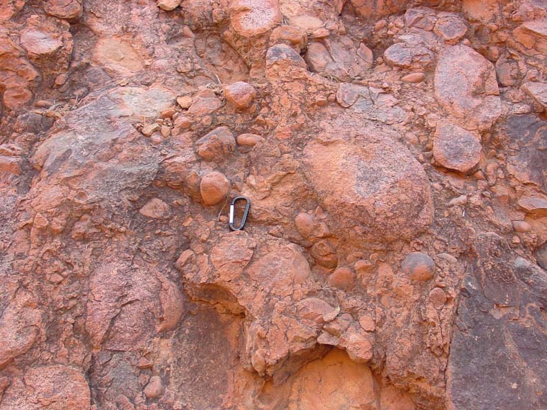
| The sandstone of Kata Tjuta is very different from the fine grained
stone of Uluru. In Kata Tjuta it is made from very large round granite
stones cemented together. The stones varied from baseball to basketball
sized. The area went through two phases of rock building. An
early phase of mountain development created the granite. These mountains
eroded and formed sediment in shallow seas that covered this area.
That area was buckled and uplifted and then all but these two (plus one
other called Mt Conan about 50 km east) eroded away. |
|